In late 1986 I was once again trying to piece together several different maps into one map of the area I wanted to hunt.
I was so frustrated that I told myself I was going to create my own map of the Hunting Unit.
In 2000 my son convinced me to try out rockhounding. Since then I have enjoyed many hours of field collecting gems and minerals.
I also obtained the equipment to cut and polish the many specimens that I have collected.
I learned how to create and revise maps during the Vietnam War and felt that I could create a map that was both useful and economical for the Hunter.
It took 10 years and advances in technology but I have finally accomplished my dream of a good quality map.
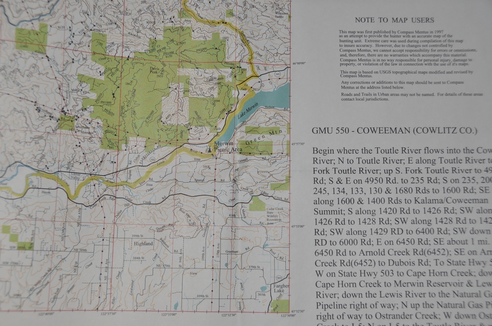
My maps start out with the USGS 7 1/2 minute quad maps as a base. I then combine information from numerous other sources and ariel photographs and place it onto the base map.
Finally I field check as many roads and road names as possible using my GPS unit.
The result is GAME TRAILS MAPS of hunting units and the GEOLOGY TRAILS MAPS of Collecting sites.
These maps have all the information that you could want on your map:
- Contours
- Streams
- Roads
- Road Names
- Public Land Ownership
- GPS Compatible Latitude and Longitude grid down to 30 seconds
- Hunting statistics Boundary description
Check out the Pigeon Springs map or the Coweeman Map?and see if you don’t agree these are the best maps available of the Game Management Units and Rockhounding sites.